Our New House
after
Hurricane Katrina
As described elsewhere on this website, we were building a new house in Waveland, Mississippi. Here is a link to the section of the website that described the progress on the house.
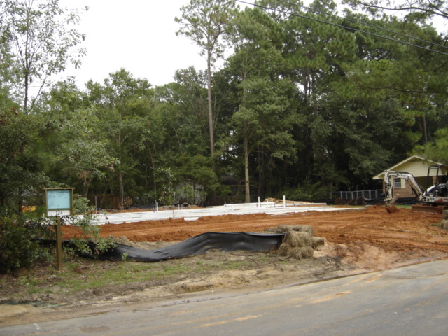
Our house was in Waveland, MS, on a lot that was 15.7 feet above Mean Sea Level. In early August, we completed pouring the slab foundation for the lot. On Friday, 26 August, I had a load of lumber delivered - mainly 2X6's for the stud walls of the house. Framing was to start on Tuesday, 30 August. Katrina hit on Monday, 29 August.
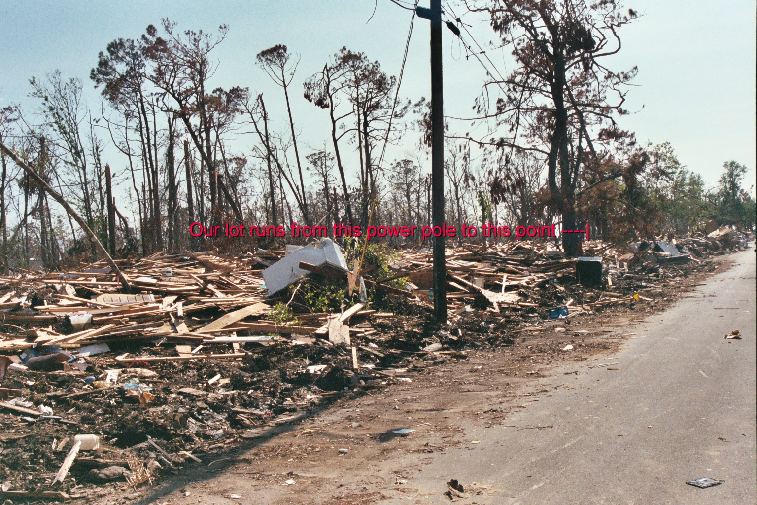
Here is the slab before Katrina, complete with plumbing under the slab, ready to start building. Note the trees surrounding the lot and the house to the right of my lot. On the left of the photo is the sign containing my building permit, which is required to be posted on the lot. To the left of this sign -- off the left edge of the photo -- is a power pole with a transformer on top. Check out the next photo.
Here is my lot after Katrina. Note the condition of the trees and the absence of the house next door. The power pole was on one corner of my lot, the red vertical bar just beyond the dead pine tree is the other front corner of the lot. The slab is in there somewhere. This power pole was located just off the left edge of the photo above.
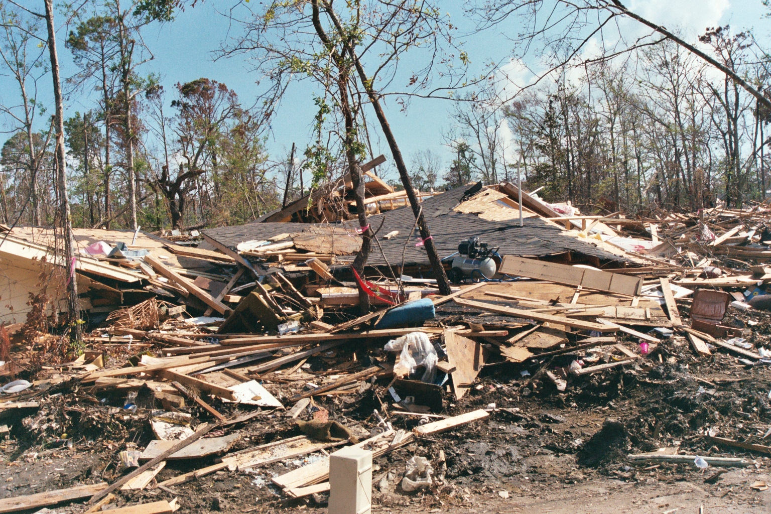
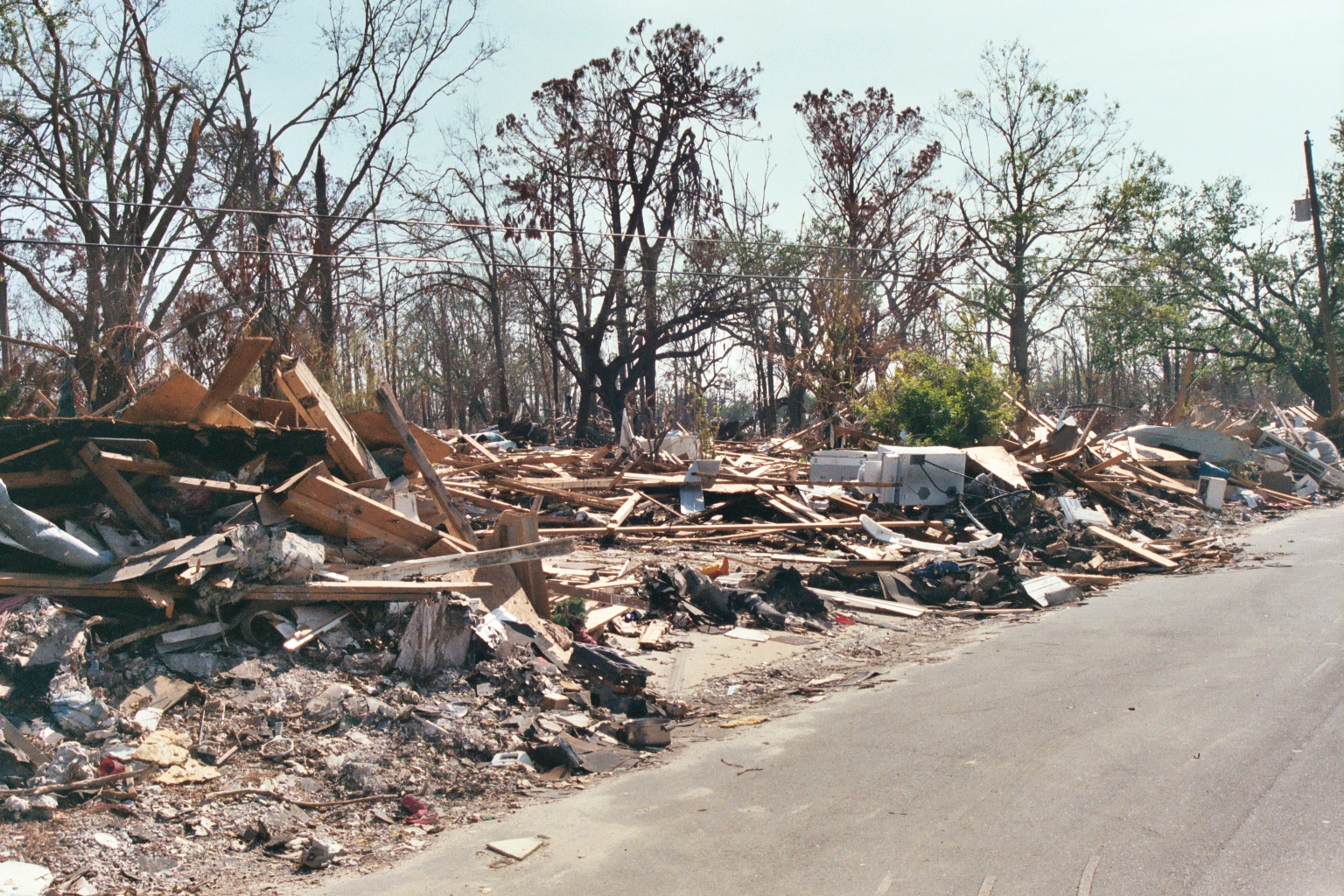
Below is the roof from the house that was to the right on my lot -- it's now sitting on the lot to the left of mine. Don't know where the rest of the house is. Don't know where the air compressor came from.
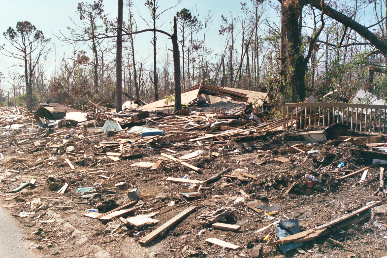
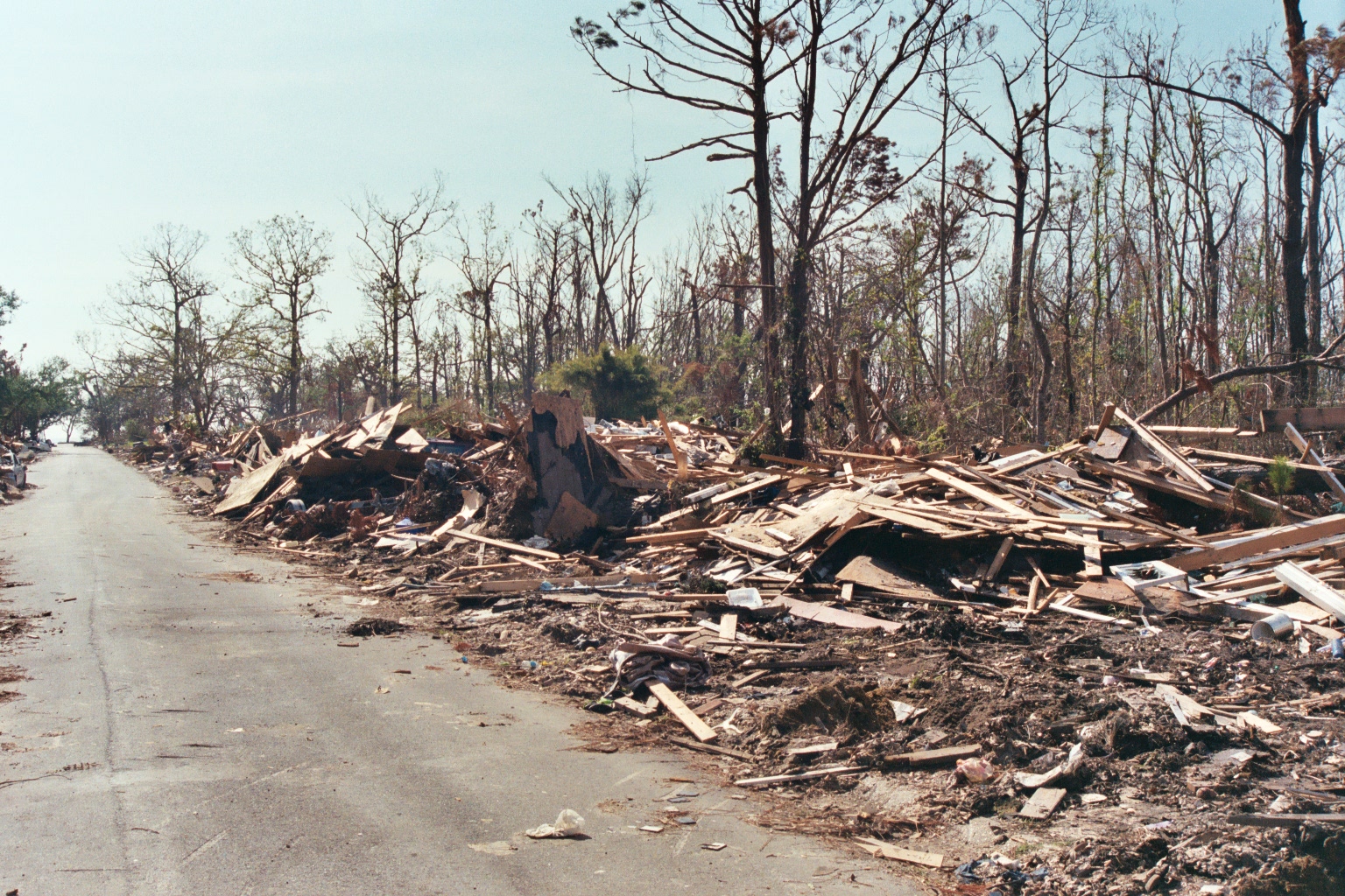
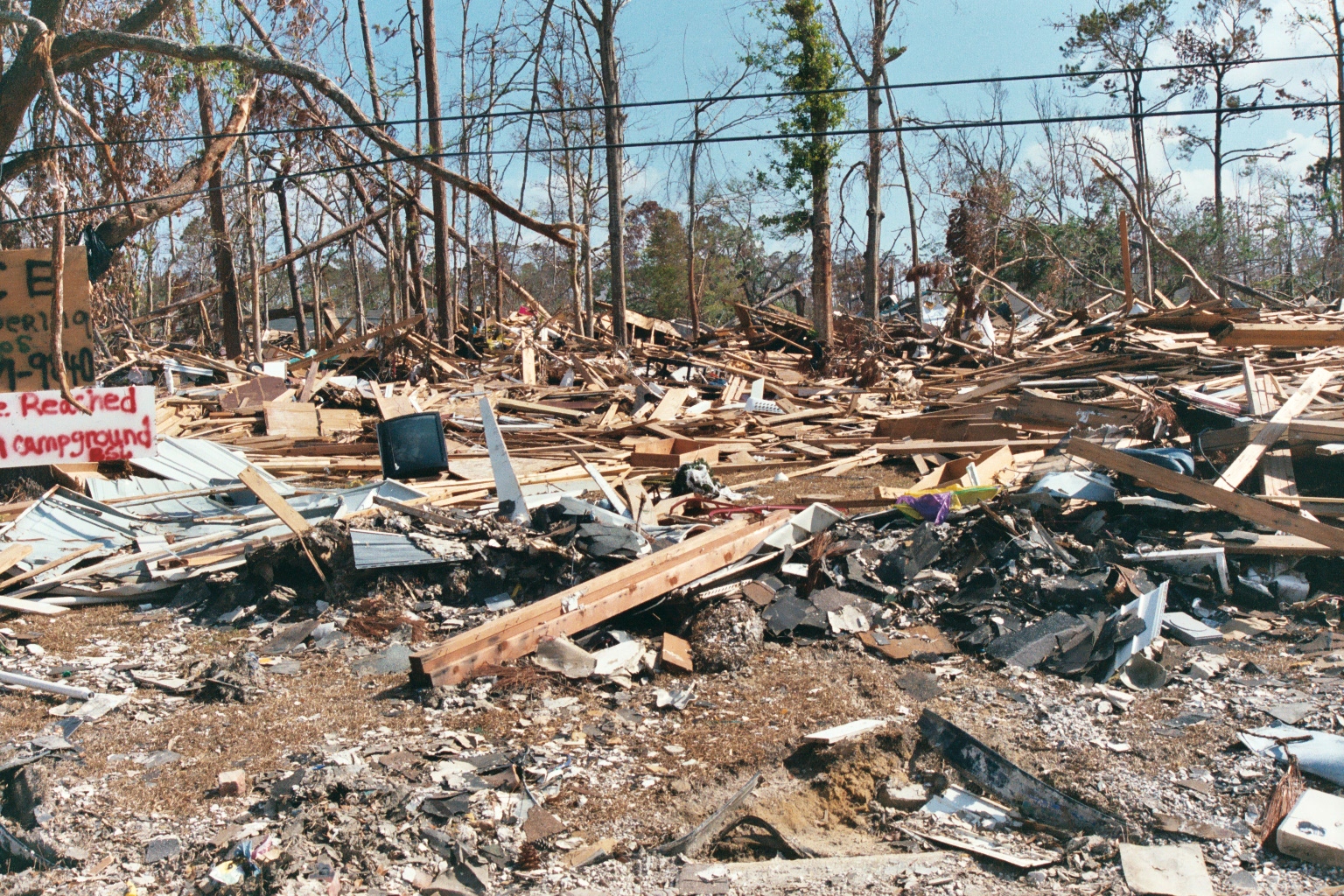
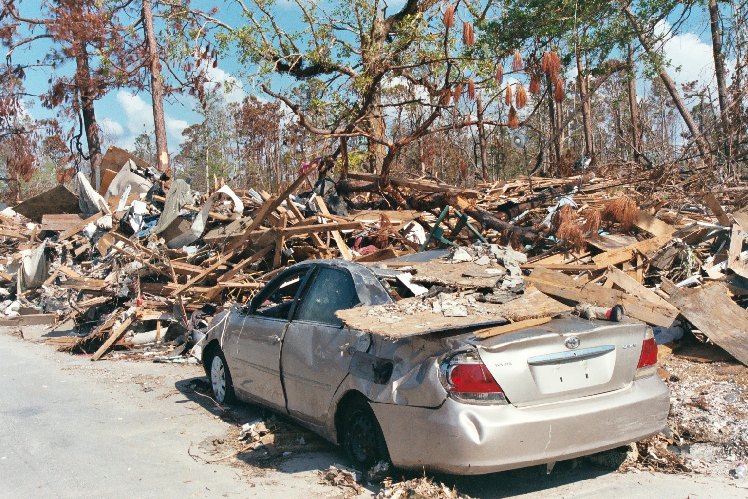
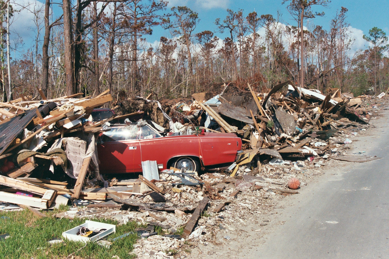
The following photographs are of my street, Whispering Pines Drive, Waveland, MS. These photos are important because they show what the ENTIRE TOWN OF WAVELAND, MS, LOOKED LIKE AFTER KATRINA. The town was destroyed -- it's not that a few houses were heavily damaged, it's that the entire town was wiped off the map -- every structure in the town within 1/2 mile of the beach was destroyed and every other structure was heavily damaged, most beyond repair. These photos were taken a week after the hurricane; the Corps of Engineers had come in and run a bulldozer up the street; before that, the street was buried under debris.
.JPG)
My neighbor Jimmy's 3,000 square foot house.
And here is an aerial photo of our street, Whispering Pines Drive.
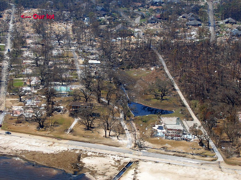
Note that the lots close to the beach are relatively clean with little debris on the lots -- when the storm surge came ashore, it swept everything in its path -- as the surge wave continued, it began to lose strength and drop debris. Thus, lots close to the beach were swept clean and debris began to pile up on those lots farther back from the beach. The houses in this photo that appear to be undamaged are ruined -- they were under water; debris smashed doors, windows, and walls; all of them will have to be bulldozed, none can be rebuilt. In the lower right corner you see a triangular-shaped pond with the remains of a house between the pond and the beach. This was a huge house -- three stories -- pond had Canada Geese and swans; the back end of the lot had a putting green and guest house.
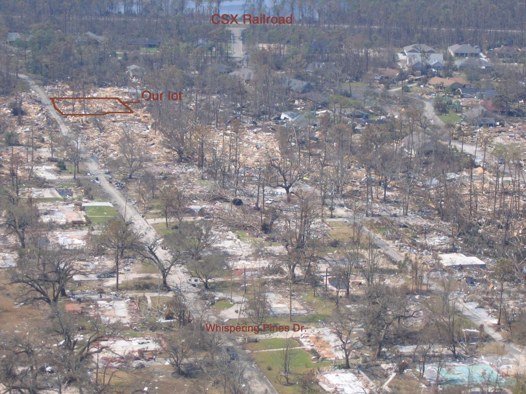
Another aerial photo of Whispering Pines Drive.
Here is a link to photos taken by another resident of our street -- Whispering Pines Drive -- on 5 September 2005, six days after the hurricane: http://www.cnn.com/interactive/us/0509/gallery.ctj.waveland/content.1.2.html
| Return to Hurricane Katrina front page. |
| Photos of our apartment. |
| Photos from Bay Saint Louis, Mississippi. |
| Aerial photos of Bay Saint Louis and Waveland |
| Aerial photos of Pass Christian |
| Photos from around the area. |