More Katrina Destruction
(Page 2)
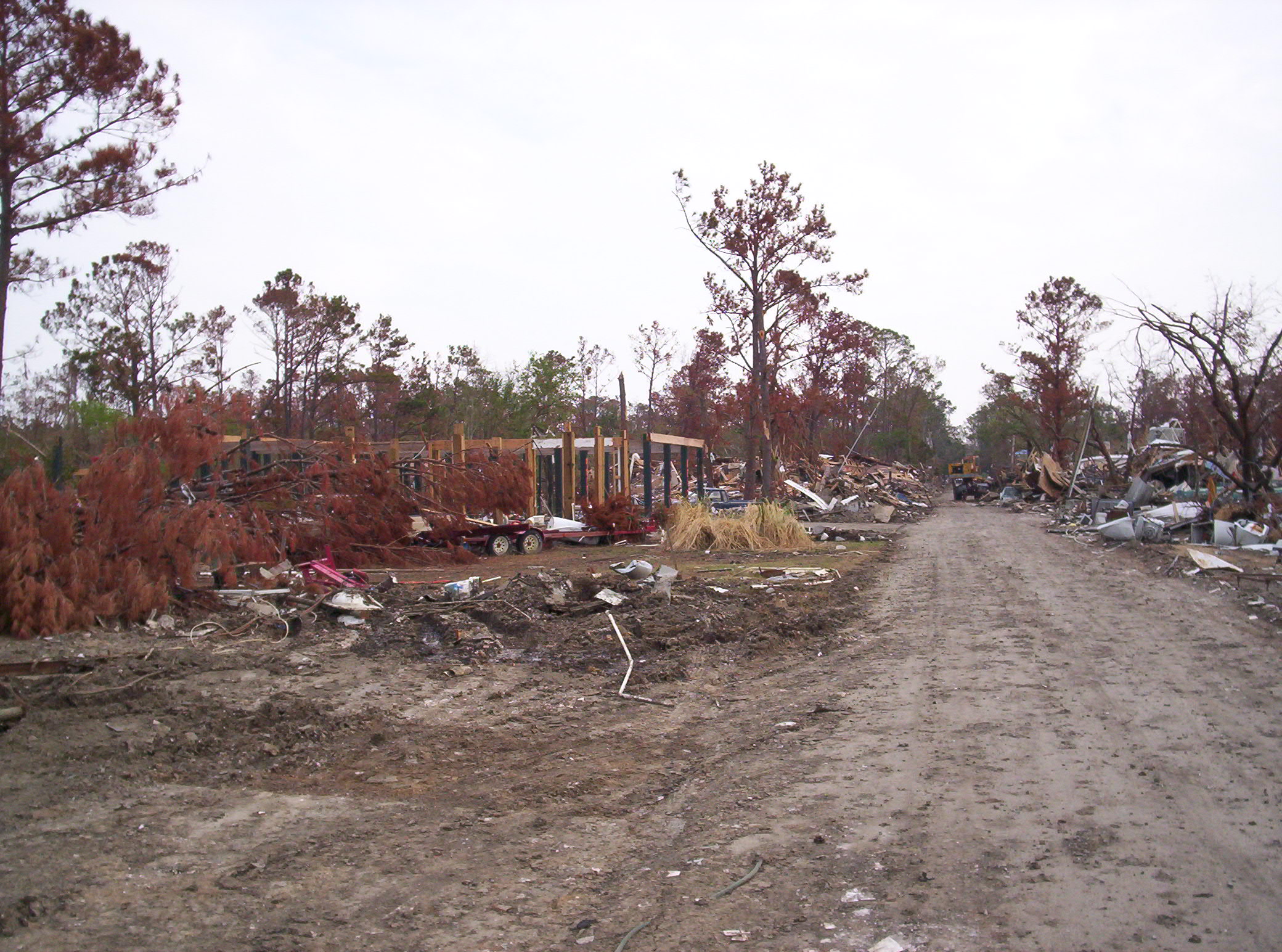
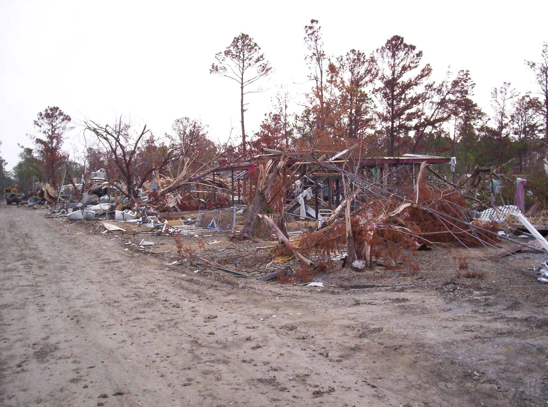
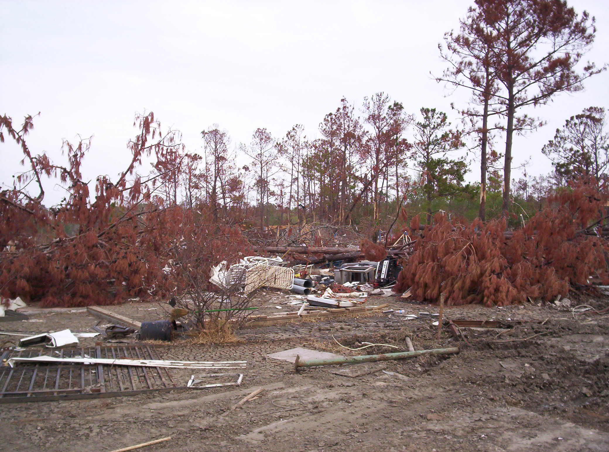
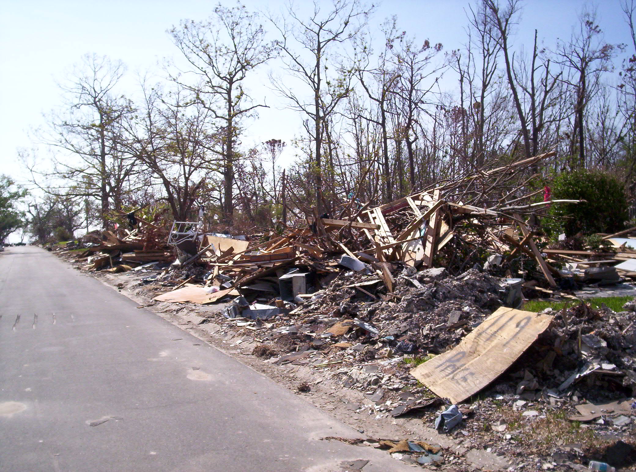
More photos of the general destruction caused by Hurricane Katrina. Remember, these photos were taken one month after the storm -- by this time, the Corps of Engineers had bulldozed the roads and streets open, people had picked up some debris, and some low-level clean-up had started.
The next three photos are typical destruction -- destruction like this extended 5-8 miles back from the beach and 30 - 40 miles east-to-west along the beach. The Mississippi Gulf Coast was, for all practical purposes, destroyed.
Houses in the area in these photos were built up on pilings 8 - 10 feet above ground level. All that remains is the pilings.
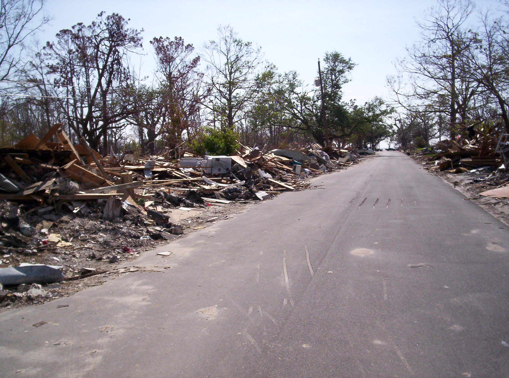
These two photos were taken as I was standing in front of the lot where we were building our home. We were building on Whispering Pines Drive, Waveland, MS approximately 1,000 feet off the beach. These photo are of the left and right sides of the street looking toward the beach -- the Gulf of Mexico is at the end of the street in the distance. Before Hurricane Katrina there were 12-15 houses on each side of the street. None survived. The entire town of Waveland, MS, looks like this.
| Back to page one of more photos from the area. |
| Return to Hurricane Katrina front page. |
| Photos of the house we were building. |
| Photos from Bay Saint Louis, Mississippi. |
| Aerial photos of Bay Saint Louis and Waveland |
| Aerial photos of Pass Christian |
| Photos of our apartment. |